Boston, the city of history, academia, and lively culture, is an exciting destination. Whether you’re a new-to-town local or a tourist, understanding the intricacies of getting around Boston can significantly enhance your experience.
Navigating through the city’s winding streets and dense traffic can be quite daunting for the uninitiated. Before I moved to Boston, I was very wary of how I would be able to get around. Thankfully, it did not take long for me to learn the ropes of how to get around Boston, both with and without my car.
This is where Boston’s impressive public transportation system comes into play – a network that connects every corner of the city. No matter what time of year you’re visiting Boston, the public transit system is ready for you. This comes in handy during the winter when those roads get icy!
Now, I’ll be sharing my best tips and tricks so you, too, can navigate through downtown Boston and beyond.
How To Get Around Boston With A Car

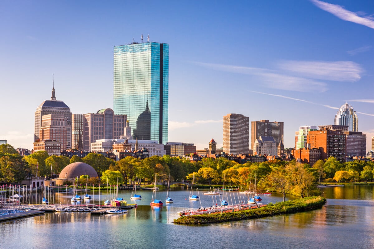
You know how New York City’s streets are all easily numbered, and the city is mapped out in a gorgeous grid system? Well, Boston is nothing like that. Surrounded by the Charles River and the Massachusetts Bay, Boston’s peninsula-like shape lends itself to many curved roads and more one-way streets than you can count.

Driving through downtown Boston is…an experience. There are plenty of self-imposed nicknames for Massachusetts drivers that you’ll hear pretty much immediately, and that should give you an idea of what driving around Boston is like.
The major highways you can see on the map above are I-93 (North/South) and I-90 (East/West). Storrow Drive follows the south banks of the Charles River.
If you plan on renting a car in Boston, either at Boston Logan International Airport or somewhere in the city, you’ll find that street parking is few and far between. There are plenty of parking garages, but this will quickly eat up your budget, and we’re all about exploring Beantown smarter, not harder.
How To Get Around Boston Without A Car
Massachusetts Bay Transportation Authority (MBTA)

The public transportation system is run by the Massachusetts Bay Transportation Authority, aka the MBTA, and it’s easily the best way to avoid Boston traffic.
Boston has a commuter rail, subway lines, buses, and ferries to help you navigate streets and waterways. The inner city metro subway (called the “T”) is best if you stay within downtown Boston and the nearby suburbs.
There are five color-labeled subway lines (blue, orange, green, red, and silver) to make it easy for visual learners. A one-way ride on the T is $2.40, payable with a CharlieCard, CharlieTicket, or cash.
The commuter rail leaves from the North or South Stations and stops in the expanding areas of Boston and nearby cities. Commuter Rail tickets can cost anywhere from $2.40 to $13.25, and you can pay with a CharlieTicket or on the mTicket app.

The bus system is extensive since they make more frequent stops, so use the maps and guidance on the website to determine which route works best for your trip. A local bus one-way ticket is $1.70 and can be paid with a CharlieCard, a CharlieTicket, or cash.
Use the ferries to explore some of the Boston Harbor Islands, like Spectacle Island, where there are beaches and hiking trails with views. The ferry prices vary from $2.40 to $9.75 and can be paid on the mTicket app or in person.
A CharlieCard is a reusable card that you can reload and is available at fare vending machines in just about all of the subway stations. A CharlieTicket is a paper ticket that you can load with whatever amount you want (you can’t add more to it like the CharlieCard). An mTicket is a mobile ticket purchased through the MBTA’s app that’s available for both Android and iPhones.
Unless you desire a memento to bring home with you, downloading the app is the best and most efficient way to take any of Boston’s public transit, including the commuter train and water transportation.
Guided Tours of Boston

The most fun and easiest way to get around town while hitting several historic sites is to take the hop-on and hop-off trolley tour.
The trolley has fourteen stops; you can ride it as many times as you need without restrictions on how many stops you can accumulate. The best part is that you can take the tour as a one-day or a two-day adventure, so you can take your time at each stop.
It will run year-round in most weather and provides winter heat for those super cold days. A tour guide rides the trolley to offer fun facts as you ride through the city, taking in the sights. It takes almost two hours to ride the trolley from start to finish if you decide not to get off at any of the locations.
The tour includes many of Boston’s top attractions like Faneuil Hall, Boston Common, Fenway Park, and many other sights along the Freedom Trail. It will also take you to the Charlestown Navy Yard, the Theater District, Back Bay, and more. It even makes a stop at the original Cheers Bar, which is a favorite for many fans of the show.
See Related: Best Salem Ghost Tours: Day & Candlelit Night Tours

You can do a traditional bike rental at multiple places in the city, but Boston also has a shared bike program called Bluebikes.
There are hundreds of docking stations around the city and surrounding neighborhoods, so you do not have to return the bike to the same location from where you booked it. Tourists can rent the bike hourly or for a single trip through the downloaded app on their phones.
Remember, there are bike restrictions with the MBTA and the Mattapan Trolley. Review regulations before renting a bike if you plan on also taking public transportation.
For scooters and electric rentals in Boston, there are a handful of businesses where you can rent one, like Boston ProScooters in Cambridge. Boston does not have Lime scooters or any other scooter program where you’ll just find one on the street. The city did try the program in 2019, but it was shut down until further regulations could be put in place.
How To Get To/From Boston Logan Airport

The easiest (and cheapest) way to get to/from Boston Logan Airport is via the T.
To get to downtown Boston from the airport, you have two options:
- The Silver Line SL1 Bus: You can board for free from any of the airport’s terminals. The Silver Line makes several stops along South Boston’s Waterfront neighborhood, but you can also ride it all the way to South Station. From South Station, you can hop on the Red Line to take you wherever you need to go.
- The Blue Line: This free shuttle bus picks up from every terminal, and you can ride it to Airport Station. From there, you’ll need to purchase a Charlie ticket to get on the Blue Line.
Alternatively, you can also take the MBTA Ferry to take you to/from the airport. The Hingham/Hull Commuter Ferry travels between Boston and the airport and will run you about $10.
While this is often the fastest route, make sure you check the schedule first. It doesn’t operate nearly as frequently as the Blue or Silver Lines.
To get to Logan Airport from downtown Boston, simply reverse the directions. You can take the Silver Line or the Blue Line back to the airport. I’d recommend taking the ferry from the airport when you arrive, and then once you’ve spent a few days exploring Boston and learning the intricacies of the T, take the T back to the airport.
See Related: Worst Airports That’ll Make You Hate Flying
How To Get To/From Boston Back Bay Amtrak

Located south of Copley Square, Back Bay station serves the commuter rail and the Amtrak intercity rail for Boston. It’s also a stop on the Orange Line. If you’re traveling further outside Boston proper, you’ll end up at Back Bay station at some point.
To get to Back Bay Station, you’ll want to get on the Orange Line. Downtown Crossing has connections with the Red Line, Silver Line, and Orange Line, so you can connect there.
From Downtown Crossing, you’ll ride the Orange Line Outbound three stops to the Back Bay Station. Both Downtown Crossing and Back Bay Station are wheelchair accessible. In fact, the majority of the train stations in Boston are wheelchair accessible.
See Related: Why Is Amtrak So Expensive? Major Factors Affecting Costs
FAQs
How early and late does Boston public transportation operate?
The hours of each train and bus can vary, but most services begin around 5 a.m. and run until 1 a.m. There is no late-night or overnight train service in Boston. You can check the schedules of a specific train or bus on the MBTA website.
Are there any pass systems to get around Boston?
The MBTA offers both 1-day and 7-day passes, which allow for unlimited travel. The 1-day pass is $11 and gives you unlimited travel on the subways, local busses, and the Silver line for 24 hours. The 7-day pass is $22.50 for the same unlimited travel. Keep in mind that children 10 and younger are free.
Can I get around Boston without a car?
Absolutely. Boston is a very safe city that is extremely pedestrian and bicycle-friendly. Boston’s intricate public transportation system makes it very simple to take the subway from one corner of the city to another for less than $3.00.
Related Resources
We take pride in providing authentic travel recommendations based on our personal experiences. We may earn a commission when you purchase a product or book a reservation. Learn more ›


