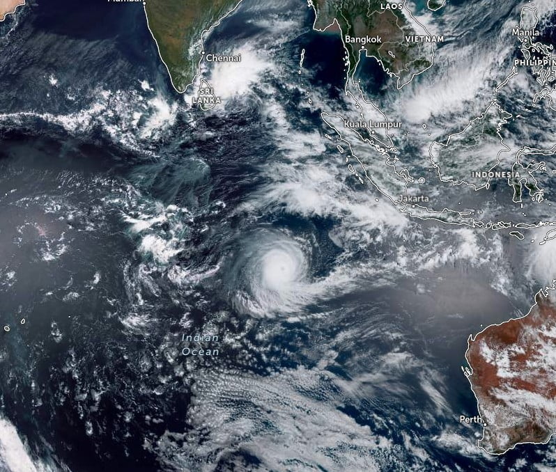
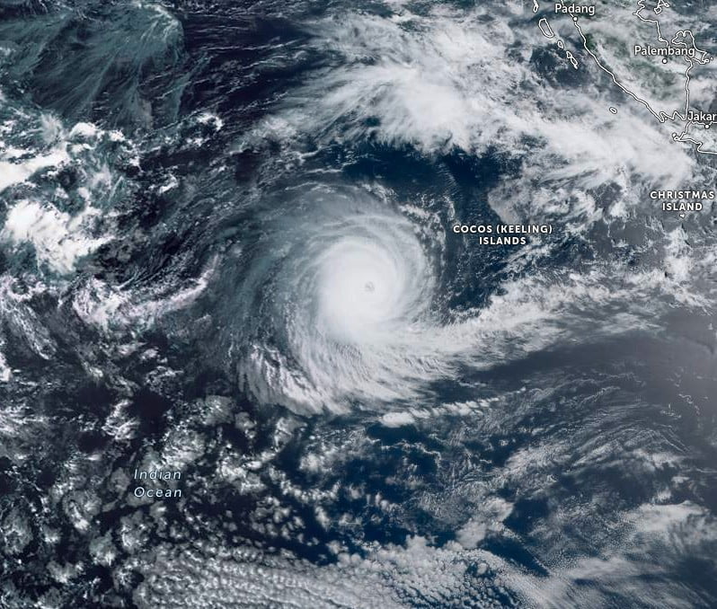
Tropical Cyclone “Darian” formed in the South Indian Ocean on December 18, 2022, as the first named storm of the 2022-23 Australian tropical cyclone season. Darian is traversing over the open waters of the South Indian Ocean and is not threatening any populated area.
On December 13, the Australian Bureau of Meteorology (BOM) reported that Tropical Low 05U developed approximately 170 km (110 miles) north of Cocos Islands, initially forecast to not develop further due to not conducive conditions.
However, over the next 5 days, conditions improved, with vertical wind shear decreasing, and at 06:00 UTC on December 18, the system intensified into a Category 1 tropical cyclone on the Australian tropical cyclones scale, receiving the name Darian.
On December 19, Darian intensified into a Category 3 tropical cyclone on the Australian scale due to a favorable environment, becoming the first Severe Tropical Cyclone of the season.
The favorable environment led to its rapid intensification and Darian reached Category 5 on December 20.


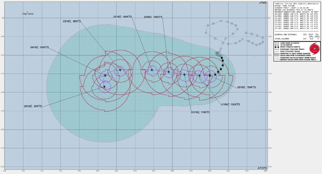
At 06:00 UTC on December 21, the center of Severe Tropical Cyclone “Darian” was located about 720 km (450 miles) WSW of Cocos Islands.
It had maximum 10-minute sustained winds of 220 km/h (140 mph), with gusts up to 315 km/h (195 mph), while maximum 1-minute sustained winds were 240 km/h (150 mph).
The minimum central barometric pressure was 920 hPa and the system was moving WNW at 13 km/h (8.1 mph).
Darian is expected to remain over the open waters of the South Indian Ocean, not threatening any populated areas, until it dissipates.

Australian Tropical Cyclone Outlook for 2022 to 2023
BOM expects an above-average number of tropical cyclones in Australian region in 2022–23.1
- It is likely there will be an above-average number of tropical cyclones for the 2022–23 Australian tropical cyclone season (November–April).
- Since Australian records began in 1969–70, the average number of tropical cyclones that form in a season in the Australian region is 11, four of which typically cross the coast.
- The established La Niña in the tropical Pacific Ocean and warmer-than-average sea surface temperatures to the north of Australia, have influenced this year’s tropical cyclone outlook.
- In La Niña years, the first cyclone to make landfall on the Australian coast typically occurs earlier than normal, around the middle of December. During average years, the date of the first tropical cyclone to make landfall over Australia is typically in early January.
- At least one tropical cyclone has crossed the Australian coastline in every season since reliable records began in the 1970s.
- Cyclone formation is rarely spread evenly throughout the season; often quiet periods are followed by bursts of activity.
- Tropical lows that do not intensify into cyclones, or lows that are the remnants of older cyclones, can still produce damaging winds, widespread rainfall, and dangerous flooding. These impacts can extend beyond the tropics into southern areas of the country.
- Like tropical cyclones, the number of tropical lows that form during La Niña years is typically greater than the number which form during non-La Niña years. From the 2005–06 season onwards, the typical number of tropical lows has been 7 for all years, and 10 for La Niña years.
Outlook by region
For 2022–23, the outlook indicates that an above-average number of tropical cyclones is likely in all but the Northern region.
- The Australian region has a 73% chance of having more tropical cyclones than average. This is also equivalent to a 27% chance of fewer tropical cyclones than average. Typically, 11 tropical cyclones form or pass through the Australian region in a season, with around four of these crossing the Australian coast. Outlook accuracy for the Australian region is high.
- The Western region has a 69% chance of having more tropical cyclones than average. Typically, at least 1 tropical cyclone in the Western region will create coastal impacts, regardless of how many make landfall. The average number of tropical cyclones to form in or pass through the Western region is 7 each season. Outlook accuracy for the Western region is moderate.
- The Northwestern sub-region has a 70% chance of more tropical cyclones than average. Typically, 5 cyclones form in or pass through this area each season. Around 3 tropical systems (tropical cyclones, or their associated tropical lows) are expected to affect coastal areas of the Northwestern sub-region. Outlook accuracy for this region is moderate.
- The Northern region has a 61% chance of more tropical cyclones than average. Typically, the Northern region experiences 2 or 3 cyclones each season. About three-quarters of the tropical cyclones in the Northern region have some form of impact upon coastal regions. Outlook accuracy for this region is low.
- The Eastern region has a 74% chance of more tropical cyclones than average. The average number of tropical cyclones for this region is 4, and around one of these make landfall. Outlook accuracy for this region is moderate.
The tropical cyclone season typically runs from November 1 to April 30, although tropical cyclones can and do form outside of those bounds.
The broader Australian region covers the area south of the Equator and between 90°E and 160°E, and includes Australian, Papua New Guinea, and Indonesian areas of responsibility.
1 Australian Tropical Cyclone Outlook for 2022 to 2023 – BOM – October 10, 2022


