Groundwater is lurking as an under-the-radar threat in coastal New York City, but officials stopped 50 years of routine monitoring in 2013. Now, environmental agencies are starting to take a deep look again.
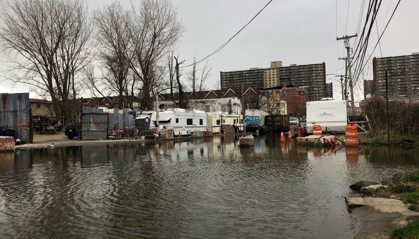
The level of the rising sea and more intense rain, both results of climate change, mean that the water stored beneath land also rises, posing an increased risk of floods — especially in places where the water table is already high, or the land lies especially low.
There are gaps in knowledge about groundwater levels across the five boroughs. The Bronx, Manhattan and Staten Island have not had consistent monitoring. The city Department of Environmental Protection (DEP) and the United States Geological Survey (USGS) monitored Brooklyn and Queens for about half a century, but stopped nearly a decade ago.
Now a new collaboration to study groundwater citywide is on the horizon.
“After an almost 10-year hiatus, it looks like we’re very close to getting hydrologic monitoring back in the city of New York,” said Ronald Busciolano, a supervisory hydrologist at the New York Water Science Center, run by the USGS. “That will be important for the long term to see if sea level rise is going to have a major impact on additional flooding in some areas, as the water table rises over a period of time.”
The five-year program to monitor groundwater levels and quality across more than 150 wells in the five boroughs should launch in the next six months, Busciolano said.
Rising groundwater calls into question the effectiveness of strategies to lessen stormwater flooding as well as plans for constructed barriers to prevent coastal flooding. Meanwhile, efforts to mitigate groundwater flooding may lead to other problems, experts say.
“It’s a relatively new issue that policymakers are considering,” said Daniel Rozell, a scientist and engineer at Stony Brook University. “As sea level rises, coastal groundwater also rises, and so if the groundwater happens to be not that far from the surface, then as sea level rises, it can cause all kinds of trouble.”
The Flow of History
For about 50 years, DEP partnered with USGS to monitor the water table in Queens and Brooklyn by examining dozens of wells. That effort ended in 2013, when DEP ruled out using groundwater as a possible source of drinking water during the shutdown of the Delaware Aqueduct for repairs. Since then, periodic monitoring of wells in Queens has taken place, but elsewhere in the city there’s been a gap in data collection and water-level monitoring.
Low-lying neighborhoods developed atop bodies of water (like ponds and marshes) tend to experience chronic flooding from groundwater, made even worse when it rains.
As THE CITY previously reported, in places like Hollis, Queens, locals have seen water bubble up from drains; in The Hole, a damp neighborhood on the Queens-Brooklyn border, residents contend with standing water in their streets no matter the weather. Last summer, owners of waterfront restaurants in Greenpoint told Gothamist they struck water after digging just six inches into their dirt basements.
Unchecked, rising groundwater can cause flooding, create sinkholes in roads, and damage underground tunnels, utility equipment, parking garages and basements. Near waterfronts, the salt in ocean water can seep into freshwater and cause corrosion. Groundwater pushing up out of toxic sites could also result in the spread of contaminants.
“We’re really talking about a permanent kind of flooding that’s seeping up very slowly from below, and it’s absolutely going to affect underground infrastructure, human health and foundations of structures before we ever see it at the surface,” said Kristina Hill, a professor at University of California, Berkeley and director of the Institute for Urban and Regional Development there. “It’ll also affect our ability to drain that excessive rainfall away.”
Installing green infrastructure — such as rain gardens and roofs with a vegetative layer — is one of the city’s signature approaches meant to prevent flooding. But experts say those projects could actually lead to more flooding — or they may not work as intended depending on the position of the water table.
“We need to understand groundwater as it relates to green infrastructure, to bluebelts,” said DEP Commissioner and Chief Climate Officer Rohit Aggarwala. “The green infrastructure, the cloudburst [projects] and the bluebelts all work much better where the groundwater is lower, and that way the ground can absorb more stormwater.”
Bluebelts are drainage systems that enhance natural watersheds to manage stormwater — like the one in Staten Island’s Midland Beach.
Unintended Consequences
Though there’s scant data about how sea level rise has affected — or could affect — groundwater in New York, the city has kept an eye on groundwater levels in some parts of southeastern Queens over the years.
Between 1996 and 2007, New York City transitioned away from relying on groundwater wells as part of its drinking water supply. Before then, pumping out groundwater since 1887 had resulted in the lowering of the water table by tens of feet in eastern Queens, where many residents now experience flooding in their basements.
“The community wanted to move away from Jamaica Water Supply [and] move to city water,” said Andrea Scarborough, a community activist and longtime resident of Addisleigh Park in southeastern Queens. “What they did not know would come was that — once those wells we were getting our water from were shut down, once they came offline — the water table would begin to rise.”
In that area, the water table was about 40 feet higher in 2013 compared to its lowest levels in the 1970s to mid-80s, according to USGS data. The levels began to rise as less groundwater was pumped for drinking water use — though they remained relatively constant between 2007 and 2013, data shows. In Queens, the USGS has continued to monitor two wells.
“The throttling back of that groundwater utilization and allowing the water table to rebound has been really the elephant in the room in terms of increased vulnerability to groundwater flooding,” said Christopher Schubert, a hydrologist with the New York Water Science Center. “Without a return to active dewatering or an increase in active dewatering for whatever purpose, that groundwater flooding is only going to increase in the face of a changing climate, particularly because of the rising sea level.”
In 2017, the DEP under former Mayor Bill de Blasio examined groundwater flooding in southeast Queens and identified possible projects the city could build — but “given constructability challenges,” opted to “work with property owners” to improve conditions, according to a 2019 letter from then-DEP Commissioner Vincent Sapienza, now the agency’s chief operating officer.
According to DEP spokesperson Beth DeFalco, the agency is evaluating methods for mitigating groundwater flooding, like implementing basins to hold and convey groundwater, installing pipes and creating a groundwater flow through streams that existed before urban development. She noted the DEP has not documented any increased damage to infrastructure due to rising groundwater at this point.
Watery Solutions
Restoring obstructed streams to their previous conditions — known as daylighting — and installing bluebelts could help “dewater” the ground, as Schubert put it. Mechanical pumps, which already are being used to protect underground train tracks and subway tunnels, are another option.
New York City Transit pumps 13 million gallons of water from the system on a dry day. Track drains collect groundwater, send it into one of 285 pump rooms and then discharge it into the sewer system. In certain neighborhoods with high water tables, like East New York in Brooklyn and Harlem, groundwater next to subway tunnels gets pumped out to keep the water table below the elevation of the tunnels.
But pumping may lead to the collapse of the ground as the water content holding the soil together goes away.
Hill, at UC Berkeley, said New York City could learn from low-lying places like Amsterdam, which has incorporated canals into its urban landscape and does “light pumping” to maintain lower groundwater levels without causing the land to sink.
She noted measures like sea walls and gates meant to protect from coastal storm surges may cause groundwater to collect behind the infrastructure — since groundwater levels near the coast typically rise in concert with the sea level.
“Even if you build a dike, it’s going to rise behind the dike,” Hill said. “This is a fundamental misconception that a lot of people have about how coastal walls and earthworks are going to protect us — actually no, they’re not, unless they’ve found a way to remove all the groundwater.”
As part of the Water Resources Development Act of 2022, Congress in December newly directed the U.S. Army Corps of Engineers to study the effect of groundwater emergence — among other climate impacts — when planning projects to protect against storms or floods.
The city’s coastal flood protection projects like the East Side Coastal Resiliency and Red Hook Coastal Resiliency projects include seepage barriers beneath the ground to hold back water from the river or harbor, according to the Department of Design and Construction. But they don’t remove groundwater.
Planting “networked trees” and other rooted greenery can lower groundwater levels as the plants suck it up, according to Walter Rodriguez Meyer, founding principal at the company Local Office Landscape & Urban Design. His firm crafted the landscape design of a housing development in the Rockaways, which has a high water table, with several green infrastructure strategies to keep it dry during heavy rains.
“It’s nature’s living pumps,” Meyer said of the tree networks, adding that the method works best in coastal zones. “That’s important because when you have storage capacity underground, when it does rain, you can handle that rainwater without flooding your neighbors nearby.”
That highlights the fact that dealing with the issue often requires a unique solution for each location.
“The way groundwater behaves is somewhat unpredictable, because there’s all these underground structures,” said Stony Brook’s Rozell. “Every little section has to be kind of treated as its own little place.”


