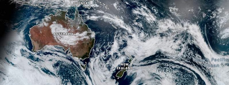
Tropical Cyclone “Hale” formed on January 7, 2023, as the first named storm of the 2022/23 South Pacific cyclone season. The system tracked into New Zealand’s area of responsibility on January 8 and was reclassified as a tropical low by New Zealand’s MetService.
- Even though Hale won’t be a tropical cyclone by the time it impacts New Zealand, it has the potential to cause heavy rain, powerful winds, and large waves
- The worst weather is expected Tuesday, January 10. However, lingering impacts are still possible across the south and east parts of the North Island on Wednesday
- There is still a lot of forecast uncertainty with this system, so it’s important to frequently check forecasts for your area
The system is currently located southeast of New Caledonia. It is forecast to move southeastwards before turning towards the North Island on Tuesday, January 10, and passing southwards over the central or eastern North Island on Wednesday. The system is expected to bring heavy rain, gale or severe gale winds, and hazardous coastal conditions to parts of the North Island and Marlborough from Monday through Thursday, January 20.1
According to MetService Meteorologist Peter Little, the most likely regions to be impacted by heavy rain are the Coromandel Peninsula, Gisborne, and Hawke’s Bay, while much of the North Island will experience gale or severe gale winds from the southeast and/or southwest.
Severe Weather Warnings and Watches have already been issued, with more areas to be added as the system moves closer and its track and intensity become clearer.
Eastern coastlines from Northland to Wairarapa are also expected to be hit by large waves on Tuesday and Wednesday.
Easterly swells of 4 to 6 m (13 – 20 feet) are forecast to affect these coastlines, potentially leading to coastal inundation and erosion around high tide.
The largest swells are expected to hit the Coromandel Peninsula, western Bay of Plenty, and Gisborne on Tuesday.
While the North Island prepares for the cyclone, the South Island is experiencing relatively settled weather due to a ridge of high pressure.
The West Coast, in particular, has been enjoying sunny and warm weather, with Hokitika recording its 4th highest maximum temperature of 28.2 °C (82 °F) on Sunday, January 8. This dry and warm weather is expected to continue throughout the week, with highs in the mid-twenties (°C) and only a slight chance of showers.
1 Cyclone Hale to bring severe weather to New Zealand this week – Met Service – January 9, 2023

