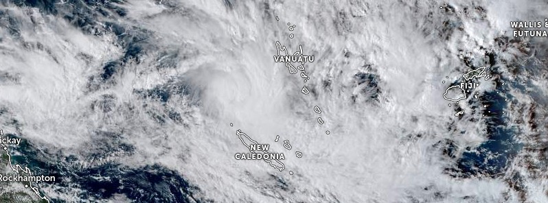
Tropical Cyclone “Irene” formed on January 18, 2023 north of New Caledonia as the 4th named storm of the 2022/23 Australian region cyclone season.
At 12:00 UTC on January 18 (23:00 LT), the center of Irene was located about 325 km (202 miles) west-southwest of Efate and 430 km (267 miles) west-northwest of Tanna.1
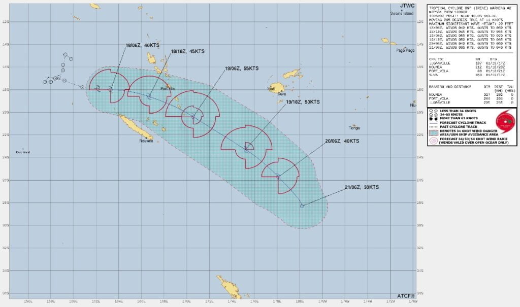
The system is moving southeastward and is expected to continue moving in this general direction over the next 48 hours, passing between Vanuatu and New Caledonia.
Winds close to the center were estimated at 85 km/h (52 mph) and its estimated pressure was 990 hPa. Damaging gale force winds of 75 km/h (46 mph) with gusts up to 100 km/h (62 mph) were expected to continue to affect the area within 260 km (162 miles) northeast of the center of the system and were expected to further increase in the next 12 to 24 hours.
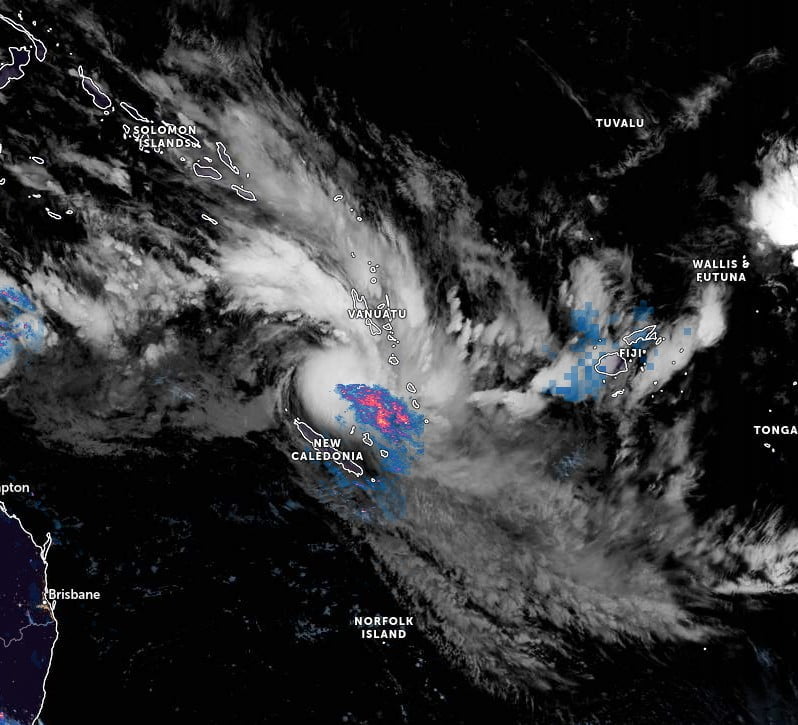
Heavy rainfall and possible flooding over low-lying areas and areas close to the river banks, including coastal flooding are expected to continue to affect Vanuatu. Seas were expected to remain very rough to phenomenal with heavy to phenomenal swells throughout Vanuatu.
The office of National Disaster Management Office (NDMO) advised that a Red Alert was in effect for Malapa, Shefa and Tafea. A Yellow Alert is in effect for Sanma and Penama, and a Blue alert in Torba.
People, including sea-going vessels, were advised not to go out to sea until the system had moved further away from the area. A marine strong wind warning was current over all coastal waters while a high seas warning was current for open waters west of Vanuatu.
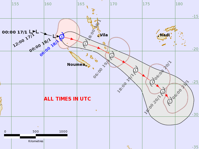
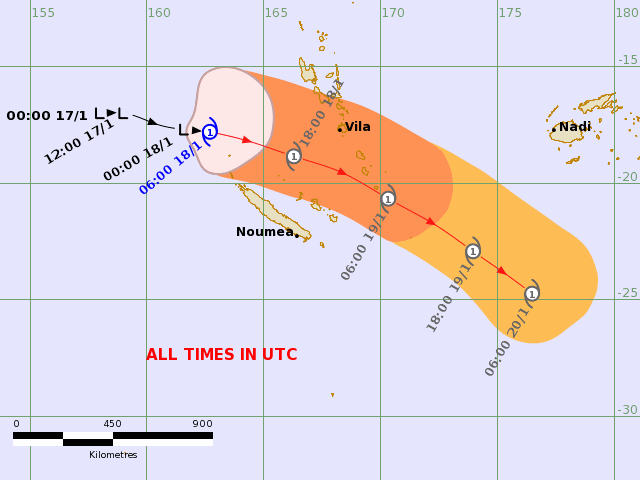
1 Tropical Cyclone Warning Number 3 issued by the Vanuatu Meteorology and Geo-Hazards Department, Port Vila at 12:00am VUT Thursday 19 January 2023.

