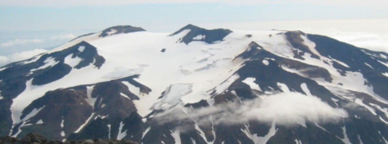
Earthquake swarm under Takawangha volcano, Alaska continues since mid-November. The Aviation Color Code remains at Yellow and the Volcano Alert Level at Advisory. The last known eruption at this volcano took place in 1550 CE (VEI unknown).
The earthquakes are generally shallow, having preliminary depths of about 3 to 11 km (2 to 7 miles) below sea level.
This activity may be due to the movement of magma beneath the volcano, the Alaska Volcano Observatory (AVO) reported on December 6.
An energetic earthquake swarm was detected under the volcano on January 23, 2017. However, the seismicity over the next 24 hours waxed and waned.
Takawangha is monitored with a local seismic network, a single local infrasound sensor, regional infrasound and lightning sensors, and satellite imagery.
The volcano lies across a saddle from the historically active Tanaga volcano to the west.
Geological summary
Takawangha is a youthful volcano with an ice-filled caldera on northern Tanaga Island, near the western end of the Andreanof Islands.
It lies across a saddle from the historically active Tanaga volcano to the west; older, deeply eroded volcanoes lie adjacent to the east.
The summit of the dominantly basaltic to basaltic-andesite volcano is largely ice covered, with the exception of five Holocene craters that during the last few thousand years produced explosive eruptions and lava flows that reached the lower flanks.
No historical eruptions are known, although radiocarbon dating indicates explosive eruptions have occurred within the past several hundred years.
This volcano is located within the Aleutian Islands, a UNESCO Biosphere Reserve property.2
1 AVO/USGS Volcanic Activity Notice – Takawangha – December 6, 2022
2 Takawangha – Geological summary – GVP


